Malinalco Archaeological Site + Chalma (Mexico), 01.10.06
GPS Track Video
GPS Cycling Data:


Distance: 110 Km. Ascent: 1560 m. Time: 5:22 hr, Avg. Speed: 20.8 Km/hr, Max. Speed: 58.4 Km/hr
Travel Report:
I started this tour at 12:30 (local time), a little bit late, but anyway, I had thought this journey would be an easy one. Things got mixed on the way. The ascent to Tres Cruces was a routine ascent of one thousand meters. No problems here so far, having employed 1:45 hr to perform this fist leg of the journey. Problems start arising at Tres Cruces, because after i had passed this summit (ca 3,200 m), a strong and cold rain fell all the way. Obviously the descent to La Marquesa is a dangerous one under rainy conditions, but there was no way to avoid it. It didn't seem as if the rain would last just a few minutes, so i decided to descent very carefully.
After La Marquesa I started the second ascent, with the advantage that the rain had now just a medium intensity. Finally, after the Conejo Valley, rain stopped. Then we started a rapid descent that would take us to the first town in the area of the Toluca Valley: Texcalyacac. Here, in Texcalyacac I had to stop because (maybe caused for the cold and rain) I had a tremendous hunger, and I was starting to fell tired. So in this town we looked for some place where to eat, and finally found a spot where big roasted chicken were being sold. After devouring one, i continued this travel.
Next town is Techuchulco, another quiet town in our path. After Techuchulco the last strong ascent awaited for our tired legs. The last hills before Joquincingo represented a 200 m ascent, but with a 5 % slope, and after 1,250 m of total ascent. I can still remember how I was strongly breathing in order to maintain a certain pace in this ascent. After finally reaching this summit, Joquincingo was in sight. After Joquiningo, started now a strong and continuous descent that would take us straight to Malinalco (we descent 1,100 m in this slope). No big problems in this stage :-)
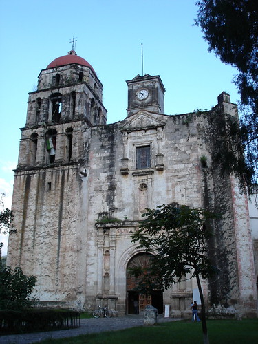
The exit road to Malinalco is paved with river stones (I have a great dislike for stone paved streets), so the driving now had to be very careful in order no to visit the ants. After arriving at Malinalco main square, we went to the Arqueological Site. Unaffortunately, I had arrived 1 hour later than the last allowed entry, so we could only took a couple of photos at the site's entrance. We returned to the main square, where we could take some shots of the Augustine Convent (and also from the running mass inside). I liked a lot the cross in the atrium of the convent, because to me it looked old and loaded with symbolism.
But it was time to head to Chalma. At about 19:30 we left the town in order to head for this mythic and religious town, destination for numerous pilgrimages. It is only a 10 km ride, but i was too late, and half of this leg of the journey had to be rode without solar light. When i arrived at Chalma, it was almost 20:00 with no light. But at least i had reached my final destination :-)
Problem was: the last Mexico bus had departed 1 hour ago (when i was taking photos back at Malinalco). Next bus runs at 03:30. What the hell. I went to the market to make some calls back home to my wife (in order to prevent hell unleashing) and decided to wait in the bus station. Heck, it was my fault i did not arrive in time, so, i was not going to give me a prize staying in a hotel. No way sir. So i returned to the bus station. But, good news ! I was not alone. there were other pilgrims there :-) We talked for hours, and as the weather favoured us (dry, 25 C) we could wait talking until almost 02:00. After a little more waiting, our return bus appeared and i got my home ticket. Bus arrived in Mexico City at 05:45, resting only a shot ride to my house in order to be home again :-) Uffff, that was really an adventurous Sunday !
Thank you for reading. Till the next journey.

No comments:
Post a Comment