August 28, 2007

Cholula Archaeological Site + Texmelucan (Puebla), 26.08.07


Photoset Map

Full Photoset Show

GPS Track: KMZ (Google Earth), or GPX (MapSource, et al).

GPS Cycling Data:


Distance: 160 Km, Total Ascent: 1302 m, Total Descent: 1260 m, Time: 06:11 hr, Avg. Speed: 24.3 Km/hr, Max Speed: 73.5 Km/hr, Energy Expended: 26.85 MJ, Power: 302 W.

Travel Report:

This ride started last Sunday at 08:20, almost three hours later than intended, as I had hoped to be able to start cycling at 05:30. I took my usual route to Puebla from Mexico City center: Ignacio Zaragoza Av. to the southeast of the city, in order to reach the junction between both free and toll Puebla highways in Los Reyes. By the way, this time the road was closed to all automotive traffic at the junction, so it was a pleasure cycling alone in the beginning of the free highway. In fact, I could take some surreal photographs of the building site that is now located in both highways. After that point, I continued cycling along the free highway, crossing on my way the whole county of Ixtapaluca. Once this county ends, the mountain climbing towards the Llano Grande summit (elev: 3220 m) starts after passing the town of Zoquiapan (elev: 3260 m).

As this time I was being chased by several fellow cyclists, I could not take any photos of the landscape in the ascent. But anyway, you have already seen lots of pictures of that ascent in my previous reports of that route to Puebla. From Zoquiapan, where I arrived at 09:55, I needed 90 minutes to reach the Llano Grande summit. Along that climb I was fortunate enough to see several cyclists that were already riding the return descent from the summit towards the Mexico City Valley. Once at Llano Grande, I found another cyclist that was climbing from Texmelucan (Puebla) towards the summit (i.e. from the other side of the mountain). As I, once I had crowned the port, started my descent towards Texmelucan, that fellow rider (who happened to live in Tlaxcala) and me cycled together a good part of the ride towards Texmelucan. It was surely fun to talk and ride that descent at more than 60 km/hr, simultaneously, although a little bit dangerous.

At my arrival at Texmelucan and before continuing my trip towards Cholula, I could pay a long overdue visit to the beautiful white church of St Mary Magdalene, in Texmelucan. This precious all white church is located not in the center of Texmelucan, but along the highway to Huejotzingo. I was fortunate enough to arrive at the church just when the most revered moment of the mass was taking place, so I could see how all the people in the church, including also the ones that could not enter in the shrine (as it was already full) and were standing out of the church,kneeled down at the consagration . By the way, it was also fine to note that there were several bicycles standing at the front of the church. After finishing my visit to this church, I went to the center of the city to buy another liter of isotonic drink and something to eat.

Once cycling again, I took the highway to Huejotzingo, which is a beautiful road in pristine conditions. It even features a side line for bicycles ! At my arrival at Huejotzingo, I decided not to stop there, as I had already obtained photos from its enormous and beautifully orange painted church. But when I reached the town of Santa Maria Zacatepec, I had to made a due stop, since this town houses a beautiful blue church, an impressive clock tower built with orange bricks, and a simple yet stunning big kiosk, built with the same orange bricks as the clock tower. I had previously desired several times to stop in Zacatepec on my way to Puebla, just to have a look at that impressive architectural group, but I had been unable to do that before, as the whole architectural group is located in the top of a hill, which is accessed only by stairways ... and this ascent is very difficult to perform riding a bicycle :-)

Ten kilometers or so after Zacatepec, I could finally reach Cholula, and, after crossing its main square, I could arrive at last in the Cholula Archaeological Site, which houses the largest man-made structure by volume in the world ! First of all, I had to leave my bicycle in a secure place, as I (obviously) was not going to be allowed to enter in the Great Pyramid with it.

Inside the Great Pyramid we (the visitors) could roam across a network of tunnels that travel across the pyramid's interior. You can have a look of those dramatic pictures in the photoset. The corridors inter-connect via staircases with the different levels of the interior, as there are several pyramids, one built atop the other, in the interior of that Great Pyramid.

Once outside the pyramid (and after recovering the lost sight, owed to the stark contrast with daylight), the church of Our Lady of Remedies could be seen at the top of the pyramid. It was a custom for the Spanish conquerors to built a christian church at the top of the most importantpre-Hispanic temples, and this case, sadly, was no exception.

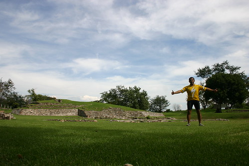
Outside the Great Pyramid stands the adjoining Archaeological Site. This huge site comprehends several impressive pre-Hispanic buildings: a Teotihuacan building, Stone Courtyard, Altars Courtyard, Mexica Altar, Building F, Buildings 1 - 6, and an Offerings Altar. As it is said that an image is worth a thousand words, I do sincerely recommend you having a look at the extensive array of photographs taken at the site, in the above linked photoset.

When I was almost exiting the site, at the foot of the Building F (the only staircase that has been restored to its initial state) I had the opportunity to observe a magnificent spectacle: the Papantla flyers ! It is really a unique chance to observe that aerial dance !

After finishing my visit to this incredible rich site, I went for my bicycle and, after crossing the center of Cholula, and its beautiful arches and Cathedral, I started the return leg of my journey. Please note that owed to the extension of the archaeological site, it was now 17:30, so my priority was now to arrive at Texmelucan, since the whole return to Mexico City in bicycle was now impossible given the hour.

But the big problem started as soon as I was leaving Cholula: a diluvial rain started to fall ! In just some minutes the whole highway to Texmelucan had been converted into a river ! I was riding in a stream of water of half meter (yes, 50 cm) deep ! I had never cycled inside that kind of water stream. And worst of all, it was an uphill road. But it was not even a road now: the water had covered the whole road (both ways) with a stream of more than half meter of deep. As the rain continued to fall, as soon as I found a place where to take cover from the rain, I stopped my insane riding. But the water level continued to rise, facing me with the possibility that the very place where I was standing were soon covered also by water. What course of action should I take ? If I rode downhill towards Cholula I was going to face more water, but at least a big city. If I choosed to ride uphills, I could find less water, but the ride was going to be a lot harder for the slope, and the next big city (Huejotzingo) was more distant than Cholula. What should I do if this crazy rain continues ?

Fortunately, after half an hour the rain stopped as by magic, so the stream over the road stopped to rise. I decided then to continue my ride uphills, towards Huejotzingo and Texmelucan. I still had to ride inside that half meter deep water stream, but it was only in the following couple of kilometers, since as far as I continued ascending, the volume of water that I found on the road diminished with the height, up to a point where, happily, no more water stream was on the road ! I can not imagine what those kind of rains could do to human settlements if the rain would last several hours, as is the case with hurricane rains.

From that point it was a piece of cake the return to Texmelucan, although a slight rain continued, there were no more rivers on the highway. In this way I could safely arrive at Texmelucan at 19:50, where I purchased my return bus ticket (AU lines, 54 pesos fare). The bus departed at 20:10, arriving in Mexico City a couple of hours later at the TAPO bus terminal. From there a short subway trip and I was again in the safety of home, albeit wet all the way to the marrow !

Thank you for reading. Till the next journey.

August 21, 2007

Teotihuacan Archaeological Site + Acolman Ex-Convent (Mexico State), 19.08.07


Photoset Map

Full Photoset Show

GPS Track: KMZ (Google Earth), or GPX (MapSource, et al).

GPS Cycling Data:


Distance: 108 Km, Total Ascent: 550 m, Total Descent: 525 m, Time: 04:03 hr, Avg. Speed: 25.80 Km/hr, Max Speed: 57.90 Km/hr, Energy Expended: 20.21 MJ, Power: 346.60 W.

Travel Report:

This ride started at 12:20 (since I had to attend some previous appointments that Sunday's morning). Being so late, I decided to make a long due ride that I had not made because its destination is relatively too near from Mexico City: the cycling ride towards the Teotihuacan Archaeological Site !

This archaeological site is only 50 km distant from Mexico City center. I had been there a lot of times before (once with the companion of fellow cyclists), but I had never gone cycling to Teotihuacan and entered in the archaeological site, in order to ascend the Sun Pyramid. Well, now I had opportunity to change this fact, and pay my debts :-)

I took Eje Central Avenue (to the north) in order to gain access to Insurgentes Norte Av. Insurgentes put me directly at the Pachuca exit highway. There were (as usual) two roads to ride towards Teotihuacan: the free and the toll highways. As I have already rode a number of times on the toll highway, I decided that this time I would use the free highway, an unknown route for me :-)

So, in Ecatepec I branched out to take the free Pachuca highway, passing soon by Venta de Carpio, where I could find a gigantic second-hand automotive market. There were kilometers of second-hand autos looking for a new owner. Next town on the route wasTepexpan . Along the ride I entered in the town of Acolman. I was already passing by it, when a fortuitous look made me realize I was going to miss something serious: the Augustine Ex-Convent of Acolman.

This Ex-Convent (a national museum) is located at the exit of Acolman, in Teotihuacan direction. I could have really missed it. Just the sheer quantity of autos trying to find a place to park made me look in the right direction. I didn't have all the time in the world, but somehow I arrived to the instantaneous conclusion that maybe I was not going to have the time and opportunity to re-visit thatimponent and enormous convent. So, making a U-turn I entered in the parking area of the site.

When I entered in the convent's atrium, I was mesmerized by the size and elegance of the building. Its sheer size imposes immediately upon the visitors. But it is its simplicity and cleanliness of lines that blow up its stunning image. It is difficult to imagine such a big yet simple religious building. And, on top of all, the Ex-Convent is located in the middle of an immense atrium, beautifully decorated with a green carpet of grass. An idyllic scene, indeed.

The facade of the convent depicts several religious images (saints and angels) beautifully sculpted in stone and built on the top of columns ofplateresque style. The arch of the door of the temple is also beautifully sculpted with religious images. A significant fact of this convent is that it is still in almost pristine conservation conditions, in spite of being built between 1539 and 1560. It really seems as the time had stopped its march on this convent. I have seen modern churches which look older than this preciously preserved Acolman Convent.

Once inside the Convent's Museum, a lot of colonial religious oil paintings can be appreciated, along with an extensive exposition of objects used by the Augustine monks that once inhabited the walls of that Convent. Not only religious items can be appreciated, but alsochapells, adoratoriums and monk's cells can be seen there. The convent features several interior halls, which house orange trees and sometimes, a water spring or a stone cross. The corridors of the convent are impressive by its elegance and size, flanked by columns and arches ofplateresque style. The jewels of the convent are the frescoes that depict some scenes of Christ Passion. Those frescoes are still admirably well preserved, as you can observe in the photographs shown in the Photoset.

After such a magnificent visit to the Acolman Ex-Convent, all that was still required was to cycle at top speed non stop ... in order to arrive at a decent hour at the Teotihuacan Archaeological Site, where I arrived at 15:50 (last entry hour is 17:30).

The Teotihuacan Archaeological Site is by far, the biggest site in Mexico, having covered in its cultural apogee a total of 38 square kilometers. with a population if 170,000 inhabitants. It houses two enormous pyramids: Sun's and Moon's, a big avenue (Dead's Avenue), several temples (to Quetzalcoatl, between them) and residential buildings. The Sun Pyramid is one of the biggest in America (second only to the GreatCholula Pyramid).

Once in the site, I swiftly proceeded to take some pictures of the Dead's Avenue, the Moon Pyramid, and of course, of the Sun Pyramid. The bad news was that rain had started to fall at my arrival at Teotihuacan ... never stopping while I was roaming around the site. So I had to made the whole visit under rainfall. Having no other course at hand, I started to climb the Sun Pyramid. I was fortunate enough to obtain some precious pictures of the vistas at the top of the pyramid, although I had towhitstand the rain and strong wind at the top of the building. I would strongly recommend you having a look at the photos of the site at the above linked Photoset show.

Owed to the rain, I had to shorten my visit to the site, so as soon as I climbed down the pyramid, I decided it was time to start the return leg of the trip, since rain was not going to stop any moment now. I cycled back towards Mexico City, riding in the toll highway up to the toll station, where I had to take a bypass, since this is the one and only toll station where bicycles are not allowed to pass. From there I took the road through Ecatepec, taking later Centenario Avenue in order to ride towards the center of Mexico City, using at the end Congreso de la Union Av, which finally delivered me (after branching out in Boturini) to the safety of home, which I reached at 19:30, with full solar light (at last) !

Thank you for reading. Till the next travel.

August 14, 2007

Jonacatepec Las Pilas Archaeological Site + Cuautla (Morelos), 12.08.07


Map Navigation: This dynamic Trackmap shows the GPS track (red line) and some geo-referenced photos (red dots) of the cycling tour. Wheel up and wheel down your mouse to zoom in or zoom out the map. Click on any point in the map to center it on that point. Or just drag the map with your mouse. To see the photos, hoover the mouse over the red dots. Click on the photo to go to the picture page.


Photoset Map

Photoset Show

GPS Track: KMZ (Google Earth), or GPX (MapSource, et al).

GPS Cycling Data:


Distance: 155 Km, Total Ascent: 822 m, Total Descent: 1,633 m, Time: 05:44:12 hr, Avg. Speed: 26.60 Km/hr, Max Speed: 64.70 Km/hr, Energy Expended: 23.47 MJ, Power: 284 W.

Travel Report:

This ride started at the very late hour of 10:00 (sadly). I guess that as I knew beforehand that this particular ride was not going to be one of extraordinary difficulty, I subconsciously decided to start it late. Well, that momentarily suited to me, as I had a previous hard Saturday, being able to go to sleep only at 02:00 on Sunday :-(

The purpose of this ride was to visit the Las Pilas Archaeological Site, in the town of Jonacatepec, in the southern state of Morelos. Jonacatepec is located 30 km south-east of Cuautla. So I had first to arrive in Cuautla. I decided to take to least-effort path from Mexico City: cycling first towards Amecameca, and from there, descending to Cuautla. The other route involves first arriving at Cuernavaca (Morelos capital), and from there riding again to Cuautla. But the route to Amecameca only involves a light ascent to 2,550 m (in Amecameca) from the 2,250 of Mexico City level. In contrast, to arrive at Cuernavaca, La Cima summit (3,000 m) must be reached first. So, the route selection was a no-brainer, although in the past I had once taken the Cuernavaca path, since I didn't know about the Amecameca route.

To reach Amecameca there also (at least) two routes. One involves crossing the south-east sector of Mexico City, reaching Tlahuac, and from there exiting the city in Amecameca direction. This is a picturesque route, since a lot of interesting city neighbourhoods are visited, being them one of the most intriguing quarters inhabited by the indigenous population of Mexico City. But this route has also the disadvantage of being too slow, since it comprises cycling along the usual city inter-quarters streets, with stop lights and traffic-negotiating corners. The other route involves arriving in Amecameca using the paid Puebla highway. This route is much less glamorous, since it only features a big and wide inter-state highway, and the associated landscapes which can be appreciated along the route ... but it is fast. No traffic lights, no corners to be worried about its traffic ... and no topes (asphalt protuberances on the road's asphalt carpet, built to deliberately slow down the traffic, in order to protect the pedestrians from speeding cars).

I took then the Zaragoza Avenue, in order to exit from Mexico City center to the toll Puebla highway. Fortunately, the gigantic traffic jam (owed to the construction of a big traffic distributor) that is usually in the place where both the free and toll Puebla highways diverge was not present at this time. I hope I had the same luck in my fore coming rides towards Puebla. This time I took the toll highway, since the Amecameca highway starts just before the Huixtoco toll station, along the Puebla toll highway.

Just at beginning of the toll highway, at Km 18, a 2 % slope opens the welcome, it is just an 80 m climb, but there was where I could reach some cyclists that were riding before me. Once again, I could ride with companion, although merely momentarily. A cyclist and me were trying to outdo the other, with this little race lasting up to the Huixtoco toll station (km 33), beating me in the last 500 meters or so. But anyway, it was a hell of fun riding against a fellow cyclist :-)


At the Huixtoco toll station I branched out of the Puebla highway, entering in the Chalco highway. The road to Chalco is a plain one, since Chalco was once a lacustre region, up to not much time ago. Fun starts at the Chalco exit, passing Tlapala, with a moderate ascent towards Tlalmanalco (2,400 m)n and later on the road to Amecameca, where a small summit of 2,550 m must be reached before descending to Amecameca (2,450 m). But heck, that was all the ascent I had to do in order to arrive in Cuautla, since from Amecameca there is only descent towards Cuautla.

In Amecameca (where I arrived after 2 hours of cycling) I took the by-pass to circumnavigate the city. I always choose the by-pass (if available), since they avoid me the ungrateful task of slowing me down passing by the center of a town I had already visited. But when the center of a town is located along the highway, I try not to lose the opportunity to pay a short visit to its main square.

Along the route, I reached Tepetlixpa, last town before the real descent towards Cuautla starts. It is a very commercial town, very apt for cliche-filling tourists. A lot of restaurants along both sides of the road offering cecina, a sort of dried and salt cooked cow meat, a really recurrent dish on that region. It seemed to me that the most appreciated cecina comes from Yecapixtla, a town in the neighbourhood. Why from Yecapixtla ? I really don't know (neither care).

I descended then from Tepetlixpa (2,333 m) to Nepantla (2.056 m) where Sor Juana Inés de la Cruz was born in 1651. Sor Juana Inés de la Cruz was the best writer of her time. She was also a nun and a poet. I curse myself for not stopping in Nepantla in my route to Cuautla, but honestly, I was unaware of the fact that I was passing by Nepantla along the descent. I promise next time I remake the route towards Cuautla (hopefully, in two weeks time), pay a much obliged visit to the town that saw birth the tenth muse, America's phoenix.

I arrived at the Cuautla entrance just before 14:00. There is an impressive welcoming arch at the entrance of the city, decorated with a mural depicting Morelos and Zapata, both national heroes of Mexico. Morelos was the chief architecture of the Independence War (1810-1821) after Hidalgo hanging by the spanish, and Zapata was the leader of the southern Revolution War (1910-1921), assassinated by orders of fellow revolutionary Carranza. Sad history, indeed.

After buying water at Cuautla entrance, I took the by-pass in order to avoid the havoc of traffic in the city center. After 7 km of by-pass, I could finally enter in the Izúcar de Matamoros (Puebla) highway. This road is a well pavemented, clearly marked road, decorated with stunning vistas alongside: a cyclist paradise, albeit full of up and down-hill swings. After 16 km, having passed by the towns of Tlayecac, I reached Amayuca, where the Jonacatepec deviation stands. From Amayuca, it's only a 3.5 km down road what was left to me before finally reaching the Las Pilas sites, arriving there at 15:40.

Las Pilas archaeological site (which has been inhabited since 1,000 BC) is unique is some interesting way: it is the only site (up to my knowledge) that is housed in a swimming pool recreation center ! Really ! In fact, I was just hoping that I would have to pay to 30 pesos required by the swimming pool administration (although on Sundays, there is no fee for the archaeological sites), but no. The door that gives access to the archaeological site is a different one, being it run by the INAH (National archaeology sites administration). Curiously, both doors (swimming pool and INAH) gave access to the same track :-) Man ...

Once being admited, the track that leads to the site passes by the pools :-) I guess that you could just jump into the water, if you were inclined to do (and avoid paying the fee), but I had no time for such divertimentos, unfortunately, as I had a mission to run: the visit to the site :-)

The Las Pilas site is not a gigantic site like others (Cholula or Xochicalco, just for mentioning some), being rather one of modest dimensions. But it is interesting in its own way, as the site features channels, as a unique water collecting system. In fact, must of the pyramids and temples in the region are associated with the water cult, which had its main religious deity in Tlaloc (rain god). The main function of those channels was to collect the water that came of the water springs, drive it to a central register box, and from there, conduct the water towards a big receptor located in the South-west bound of the plaza. From here water was diverged towards the population centers and agricultural fields. In fact, those channels (and associated water cult) were so important to the population, that some of the out-of-use channels were used to perform ceremonial burials. In those burials, the people was earthed in the channels in special positions, like the Lotus, accompanied by religious artifacts, as the small statuettes (Tepictocton) representing the Tlaloques: Tlaloc helpers. Aside from the engineering feats of this site, it was a beautiful place to be. The green grass put an idyllic touch to the scene, along the delicately modulated slopes of the hills that built the site.

Once finished the visit, I proceeded to visit the downtown, where a beautiful yet abandoned Augustine St. August Ex-Convent can be appreciated in all its past glory. It certainly give its viewers an impossible feeling of melancholy. You can have a look at it in the photoset.

It was time now for the return leg of the journey, although merely to Cuautla. I rode back towards Amayuca (a gentle uphill slope), where I could buy a much needed water replacement, since those places are really hot indeed, and the sun had been the Highness it is accustomed to be, with no rain or even clouds that interfere with its power. From Amayuca I cycled back towards Cuautla, reaching its downtown at 18:30.

The Cuautla's downtown was absurdly full of people ! More people per square meter than in the Mexico City Zocalo ! I asked a local if there was some festivity in town, just to explain myself the cause of so much people, and he told me that no special fiesta was hold on that Sunday, It was just that every Sunday was the same. There was a Danzón public ball between the kiosk and the municipal palace. A lot of elder people were taking part. It was an interesting show to witness. After taking some pictures of the beautiful and imposing Cathedral, I decided to return to Mexico City.

At 19:30 I took the Estrella Roja bus (74 pesos fare), which, owing to the rainful weather conditions along the highway, a trip that is usually made in 2:30 hours, this time was accomplished in 5 hours ! Arriving in Mexico City at 00:30, there was no more Metro (subway, closes at 00:00) to take this time to arrive home, so a modest ride from the South Bus Terminal (in Taxqueña) to the center of the city was all that was required to arrive back at home's safety :-)

Thank you for reading. Till the next travel.

August 07, 2007

Tepexi de Rodriguez + Tecali de Herrera (Puebla), 05.08.07


Map Navigation: This dynamic Trackmap shows the GPS track (red line) and some geo-referenced photos (red dots) of the cycling tour. Wheel up and wheel down your mouse to zoom in or zoom out the map. Click on any point in the map to center it on that point. Or just drag the map with your mouse. To see the photos, hoover the mouse over the red dots. Click on the photo to go to the picture page.


Photoset Map

Photoset Show

GPS Track: KMZ (Google Earth), or GPX (MapSource, et al).

GPS Cycling Data:


Distance: 228 Km, Total Ascent: 2,056 m, Total Descent: 2,469 m, Time: 9:43 hr, Avg. Speed: 23.4 Km/hr, Max Speed: 64 Km/hr, Energy Expended: 39.12 MJ, Power: 280 W.

Travel Report:

Alas ! At last, a ride that starts early ! At 05:55 I was already taking the first picture of the journey. This means that at 06:00 I was already cycling towards my destination: the Tepexi el Viejo Archaeological Site, in the eastern state of Puebla.

From my house (near Mexico City center) I took Fray Servando Av., in order to gain access to Ignacio Zaragoza Av., a very long avenue that drives directly to both (free and toll) Puebla highways. I choosed to take the free highway, reaching the start of the Puebla free highway (and the end of the urban zone) at 07:15. According to this timetable, I could start the next time the ride half an hour before, at 05:30, since at 06:45 there is already sunlight on the road.

The landscapes along the route at that early hour, just when the sun has still not risen, were breath taking. It was almost phantasmal the combination of light in the sky and darkness on the mountains. The sun behind the mountains gave a strong contrast between day and shadows. It is maybe because I am not really accustomed to get up before the sun that those landscapes seemed strangely alien for me, just as if I were in another planet :-) You can have a glimpse of those precious vistas at the photoset show.

From Mexico City level (2,240 m) I continued the ascent to Avila Camacho (elev: 2,900 m), and later, up to the Llano Grande summit (elev: 3,200 m). On my way up to the summit, I was blessed with the companion of several fellow cyclists, die-hard ones. They were climbing this summit with one-speed bicycles ! You have to have legs if you want to climb this 1,000 m ascent along just 20 km (grade: 5 %) with just one gear ! And I have still to say that I was overrun by some of those formidable cyclists (but not by all).

A fellow cyclist and me reached the Llano Grande summit at 09:00, from where a steep descent drove me to Rio Frio, and after the Potrero Bridge, also to Santa Rita Tlahuapan, first town on the road once the Zoquiapan National Park ends.

Continuing the descent, I crossed several towns like: San Matías Tlalancaleca, San Lucas, San Rafael Tlanalapan, finally arriving in San Martin Texmelucan at 10:10. In Texmelucan I made a short stop in order to buy some fresh fruit and water.

From Texmelucan I took the road to Huexotzingo. This free highway is superbly pavemented, it even features a side lane, of the same quality as the car lanes ! A God gift. Besides, along the road some impressive vistas of the volcanoes could be appreciated. Reaching Huexotzingo at 11:30, I decided to pay a short visit to its beautiful church, decorated with a stunning and incredible beautiful orange color.

Later on the road I reached Cholula, home of the imposing Cholula Archaological Site, already visited (if you are interested, you could review my previous Cholula report). I could not enter in the city, since time was a scarce resource, so I continued by the Quetzalcoatl boulevard (painfully bad pavemented) towards Puebla City.

In Puebla City, again, I could not enter in the center of the city, since I had already been there, and more important: the clock was ticking. So I by-passed the center using the Circuito and soon gained access to the Valsequillo Boulevard, road that would take me directly to the Africam (an open-air Zoo), in the Valsequillo Dam. From the Valsequillo branch, the route took me towards Tecali de Herrera, a place which reputedly was once the house of Quetzalcoatl.

In Tecalli de Herrera a beautiful church can be appreciated but, its main attraction is the Franciscan Ex-Convent (properly a Basilica: three naves separated by columnades with semicircular arches), built between 1540 and 1569. It is an enormous and gigantic ruin, that in this day consists merely on its mail walls, columns and arches, since the rest of the building is no more ... even its wood roof was taking apart, for making a bull rodeo in 1920. Could you imagine that ?

I would certainly recommend you having a look at the imposing views of that gigantic Ex-Convent in the photoset. Those views are certainly a kind of its own. In fact, this was the first time I had ever seen such a magnificent opus, turned down to its mere ruins and vestiges.

From Tecali and before I reached Ahuatepec, only cruel desert awaited me. The landscapes of those desert places made me remeber the phrase that Dante (in the Divine Comedy) put at Hell's entrance: Abandon all Hope all You who enter here. Man ... the desert is indeed a desolated place. I was just hoping nothing bad occurred me (as a broken chain or whatever other mechanical failure) in those desolated realms. At some point in the road I found the famous Sifon, an enormous aqueduct cliff bypass. It is really an imposing piece of architecture. I don't know when that Sifon aqueduct was built, or by whom, but certainly it's a breath-taking building, not just by its enormous size, but also by its location: in the middle of a desert.

In Ahuatepec the desert finishes and lots of water appears from no-where (as far as I could see). As soon as I was reaching Ahuatepec, the humidity of the air increased, and for a reason: there is an open water channel, that coming from Ahuatepec, I imagine, supply water to Tecali. In fact, there is so much abundance of water after Ahuatepec, that in Atoyatempan (the following town), I could observe fields being irrigated ... by aspersion ! Just a few kilometers after the desert. A strange land, indeed.

In Tepeyahualco (next town along the route) I decided to make a second short stop, because I was starving, and lacking water. After the renewal of my reserves, I cycled towards the last stop before reaching the destination: Molcaxac. Molcaxac is a picturesque town, last big town before Tepexi. I decided to pay a short visit to its simple yet beautiful church, painted with a pale blue color, and its adornments in white.

Just before I reached Tepexi de Rodríguez, along the road I could enjoy and
indescribable view: A Saguaro forest. I had only seen once the Saguaros (on a previous car travel to Oaxaca), but this time I could stop along the road and breath its beauty. Being the saguaros desert plants that grow to an enormous size, the panoramic view was just incredible. The sheer beauty of those desert plants and the imposing silence of the valley gave the scene an almost surreal atmosphere. And in the background, my destination: Tepexi de Rodríguez.

I reached Tepexi de Rodriguez at 19:30. I went straight forward to the church, to have a look at it and to take the compulsory photograph. From the church the road to the Tepexi el Viejo archaeological Site could be observed. It was a 10-km off-road hill-crossing way. I needed at least a couple of hours to get to the site and return to the town, and I had only 30 minutes of light ... Man, what else could I do ? Nothing. I had to accept the fact that on that day, I was not being able to visit the site. Although I had started the journey at 06:00 and I had tried not to make too many stops, the full route (up to the archaeological site) proved to be, at the end of the day, too long to be made in only one day. I need two days for that visit.

So, after accepting that fact, I had to contempt myself with roaming around town and taking pictures of it. Another problem: the return to Mexico City: the last bus to Puebla had already departed at 19:30, with the following bus passing by at 04:00. I was tempted to pay one room in the town's hotel, but heck, I had never needed a hotel room (on my previous one-day cycling tours), so, I was not going to change this trend ! I went to the local market to eat some (ten) tacos de cabeza (only delicacy available in town), roamed a little more, and when I was so tired that I could stand no more, I went to the town's park, in order to rest at least three hours, just to wait the oncoming 04:00 bus to Puebla. I almost felt asleep, but then I remember the cost of my equipment, and somehow I lost the sleep, having to contempt myself with resting the body, although not the mind. At 03:45 I went to the junction were the bus was going to pass and waited.

The town at that hour made me remember Comala, the ghost town of the Pedro Páramo Rulfo novel. The town resembled in fact a ghostly town. I was just half-heartily waiting to appear some anima at the round of the corner :-) Anyway, the bus arrived punctually at 04:15, and for a fare of 65 pesos (plus a 10 pesos unofficial fare for the bicycle) I arrived in Puebla's CAPU (bus central station) at 06:30, from where I again took another bus, this time direct to Mexico City (82 pesos), which departing at 06:50, put me again in Mexico City (at the TAPO eastern bus terminal) a little before 09:00 (delay caused by lots of traffic at that rush hour). A 10-minutes cycling ride and I was again back at home's safety, but with a hard day oncoming ... and hardly any sleep. But heck, this is what cycling is all about, isn't it ? :-)

Thank you for reading. Till the next travel.