Huamango Archaeological Site + Acambay (Mexico). 29.07.07
Map Navigation: This dynamic Trackmap shows the GPS track (red line) and some geo-referenced photos (red dots) of the cycling tour. Wheel up and wheel down your mouse to zoom in or zoom out the map. Click on any point in the map to center it on that point. Or just drag the map with your mouse. To see the photos, hoover the mouse over the red dots. Click on the photo to go to the picture page.
Photoset Map
Photoset Show
GPS Track: KMZ (Google Earth), or GPX (MapSource, et al).

Photoset Map
Photoset Show
GPS Track: KMZ (Google Earth), or GPX (MapSource, et al).
GPS Cycling Data:

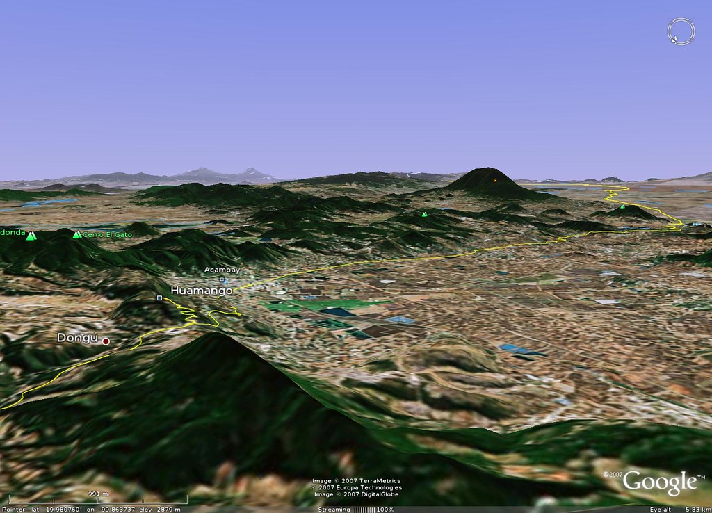

Distance: 166 Km, Total Ascent: 1,840 m, Total Descent: 1,575 m, Time: 7:17 hr, Avg. Speed: 22.7 Km/hr, Max Speed: 72.2 Km/hr, Energy Expended: 32 MJ, Power: 306 W.
Travel Report:
This ride started past 07:00 (one hour later than expected). I took the usual route to Toluca (Constituyentes, and later, the Toluca free highway). On my way up to Las Cruces summit, I was lucky enough to find several fellow cyclists riding along the ascent ! As I am already accustomed to ride solo, this companion was a very fortunate coincide for me :-) I could take some photos of them after reaching the summit at 09:00.
After La Marquesa I continued descending towards Lerma and Toluca, where I took the Atlacomulco branch (just where the Tollo God monument stands) at 10:10. I knew that the Huamango Archaeological Site closes on Sundays at 15:00, so had to make few stops (if any) to take photographs along the route. This saddened me a little, as I love taking pictures of the landscapes and important landmarks of the road, but this time, I had no time for such divertimentos. From Toluca, I had less than five hours to reach the site, and the clock was ticking.
Fortunately enough, I had already made the same route (up to Atlacomulco) just a couple of weeks before, when I paid a visit to the Mazahua Ceremonial Center, so, if you are in the mood of having a look at the beautiful landscapes along the route, please check my previous Mazahua CC report.
The road between Toluca, Ixtlahuaca and Atlacomulco is a superb paid highway. It even features a good side lane (plus the two usual automotive traffic lanes). But as I had no time to lose, I decided not to use the side lane (a little bumpier), using instead the right side of the first traffic lane. In this way I could ride a little faster. I had thought that the autos would be honking me for using their lane (existing an available side lane), but to my fortune, the drivers along that highway were always courteous and polite, by-passing me using their left lane ! This was important, since cycling that 60 km ride on the cars lane is always an uneasy ride :-)
The 60 km highway to Atlacomulco is mainly a plain ride. The weather was beautiful: not a strong sun, no rain and no winds: a cyclists dream ! This allowed me reaching Ixtlahuaca at 11:30 and Atlacomulco at 12:50. (My self-imposed limit for reaching Atlacomulco was 13:00).
After stopping a little in Atlacomulco for buying water and some food, I started the required climbing along the road towards Acambay. This climbing consists of two peaks, the first of 200 m and the second of about 100 m, nothing to worry, but I had already started cycling with an eye in the clock.
I stooped once more in Acambay (reached at 14:11) to replenish my water bottle as I knew a good ascent was in front of me: an almost 400 m climbing in 7 km (grade: 5.71 %), with the last leg of the journey (after the site landmark in Dongú Puerto) being a cruel climbing: 150 m of ascent in only 1.5 km: a 10 % grade ! This road has even deep markings on the pavement, in order to avoid autos skidding !
Everything was going right, I passed Dongú, Dongú Puerto, Bovini ... and passing by the site entrance, I continued riding, this time downwards to La Florida, where a police man gave me the bad news: I had already passed the Huamango Site entrance. Man ! I was already 100 m down. So I had to re-climb those 100 m (with the clock against me) and from Dongú Puerto, take now the right path towards the site.
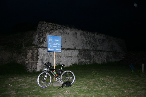
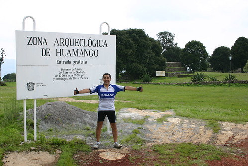
I managed to made those climbs and at 15:10 I could finally reach the Huamango Archaeological Site, situated at an elevation of 2,900 m (GPS coordinates: 19.978985796, -99.864121629).
After 160 Km and 1,850 m of climbing I had arrived ten minutes later ! Man ... but I had to do something. So I talked to the site guardian, whom by an extremely fortunate coincidence, was still at the site, picking some things on his truck. So I told him from where I was cycling, and the purpose of my visit. I politely asked him if, by any chance, he could allow me to enter in the site, just in order to take the compulsory photographs. After some tries, he acceded .. and I could finally enter in the site !
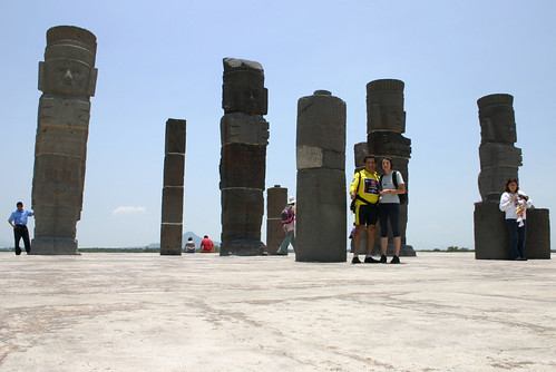
More than happy I roamed a little across the site, taking some pictures of the incredible beautiful Otomian buildings. Those buildings included a Palace, a Warrior Temple (with a christian cross at its top) and an Adoratorium. There are even still some vestiges of the stone wall that once protected the ancient city.
The guard had allowed me only a limited amount of time to visit the site, so I could not make a more detailed tour. I just could have a look at its more imposing features. But they were anyway imposing enough to stunne me. Besides, the whole site is covered with a beautiful green grass carpet :-)
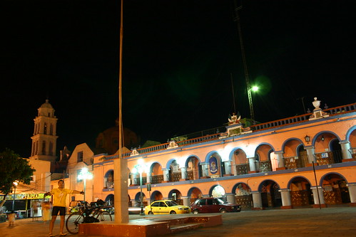
After finishing my visit, I started a slalom descent (400 m in 5 km) towards Acambay, where I had planned a visit to its center and man square. But, the weather had thought otherwise, since as soon as I entered in Acambay, a cold diluvial rain (hail inluded) started to fall ... Man, is good to be in town when one of those rains starts to fall !
I waited for half an hour, hoping the rain would soon disappear and let me make my visit to the town's main square, but after waiting almost an hour, with the rain showing no signs of weaning, I decided to take the bus to Mexico City.
I had previously planned cycling back towards Atlacomulco at least, since I had plenty of time in this ride, but no one with a healthy mind was not going to ride under hail, if he could avoid it :-) So I left this time the rain for the next occasion and, for a 85 pesos fare, I boarded the 18:00 direct bus, from Acambay to Mexico City, which promptly (after 2.5 hours) delivered me to home's safety :-)
Thank you for reading. Till the next travel.
