Cortes Pass + Amecameca (Mexico), 20.11.05
Photoset Show
GPS Cycling Data: Distance: 64.1 Km, Ascent: 1715 m, Time: 5:01 hr, Avg Speed: 15.1 Km/hr, Max Speed: 51 Km/hr
Travel Report:
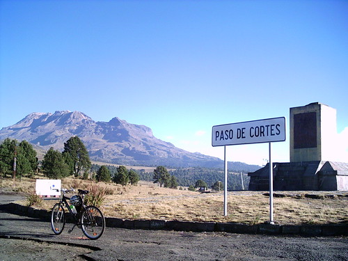
This ride started in La Paz eastern sub-urban train terminal station. I took the paid highway to Puebla. Before the Huixtoco toll collect station I took the Amecameca deviation. After I short stop in Amecameca, I continued my road to the 3700 meter high Cortes Pass.
I don't remember at what time did I leave my house that day, but it was certainly late. So I arrived late at Amecameca. On my way to the Cortes Pass I rode first to the nearby town of Nexapa. After this last town in the route, only pure ascent on my way to the summit awaited for me.
I don't remember at what time did I arrived at the Cortes Pass summit, but it was really late. There was no much solar light then :-(
I could take some photographs of the incredible vistas on that mythical summit. You can have a look of the Popocatepetl and Iztaccihuatl volcanoes as seen from the Cortes Pass summit at the following photoset.
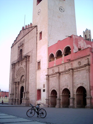
Later I descended to Amecameca, from where I could take some pictures of this beautiful city. Some buildings that are worth paying a visit are its Cathedral, Municipal Palace and Central Park (kiosk inluded). Later I started my return trip to Mexico City.
Meanwhile, my wife, who had arrived to Amecameca independently (not by bicycle), had been very active photographing some beautiful pictures of Amecameca, and particularly, from the beautiful and not so known Park of Sacromonte, up ahead over a hill surrounding Amecameca. These pictures show one of the most intriguing church I had ever seen in my life ... The church in the upper part of the Sacromonte looks like a very ancient and abandoned church in Transylvania, if you allow me the comparison. Please have a look at this mystic church at the following photoset.
Thank you for reading. Till the next journey.


