Atlacomulco (Mexico) by Jilotepec (Hidalgo), 28.01.07
Map Navigation: This dynamic Trackmap shows the GPS track (red line) and some geo-referenced photos (red dots) of the cycling tour. Wheel up and wheel down your mouse to zoom in or zoom out the map. Click on any point in the map to center it on that point. Or just drag the map with your mouse. To see the photos, hoover the mouse over the red dots. Click on the photo to go to the picture page.

Photoset Map
Photoset Show
GPS Track: GPX (MapSource, et al), or KMZ (Google Earth)
GPS Cycling Data:


Distance: 148 Km. Ascent: 1152 m. Time: 6:19 hr, Average Speed: 23.3 Km/hr, Energy expended: 26.94 MJ, Cycling Power: 296 W, Specific Power: 3.94 W/Kg.
Travel Report:
This ride was intended to arrive at Acambay, but as I started to cycle at almost 12:00, there was no so much time to arrive at the proposed destination, so I needed to cut the route short and land in Atlacomulco, instead of Acambay (which will be the destination of my next journey). I really _need_ to wake up early on Sundays, man ...
OK, so I decided to cycle the route (not withstanding the hour) and took Marina Nacional, Parque Vía, Puente de Vigas in order to arrive at Tlalnepantla. Then took the free highway to Cuautitlán, joining the paid highway at Tepozotlan (just at the toll station). Continued on this highway to Coyotepec, Tepeji del Río (Hidalgo state, alt: 2150 m), up to Km 82 where I found the deviation to Jilotepec. Nice ascent by the way (300 m from Tepeji), and carried out in the merciless heat of the desert. Compared to the south, the cycling travels to the north of the city have always resembled me like travelling in a desert. Dry air, no water in sight, and not template temperatures (and very few people and towns, by the way).
The ascent continued all the way to the unheard (to me) towns of Rincón de Bucio, Tlazapan and Acuitzilapan, arriving at an altitude of almost 2800 m. Somewhere between this towns I got a flat tire (my first one in more than two years of cyclotouring), but as the air was escaping very slowly, I managed to put more air in the tire in Sn Marcos (at a car repair shop), so making no more stops I could manage to arrive at Atlacomulco without having to change the tube :-) As it was already late and light was now a luxurious asset, I desperately needed time.
After Sn Marcos I lost solar light, so I had to cycle again in darkness (cursing myself for not having waked up earlier). The problem started in the next town: Acuitzilapan, because in this town, the road reached its maximum height (ca 2800 m) and started the descent all the way to Atlacomulco (2550 m). The tricky part was that I had to ride this descent in the darkness, and without lights ... in a two lane road. Well, I have made worst no-lights nocturnal descents (from Llano Grande at 3200 m to Mexico City at 2250 m, on the paid highway to Puebla), but they have always made me feel nervous.
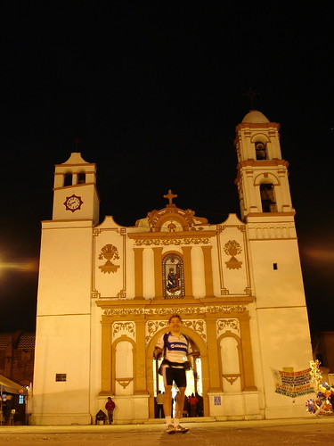
At my arrival at Atlacomulco (at 19:30) I went to the Main Square, where the Cathedral, Municipal Palace and School of the city can be appreciated. After taking some photos, I went to the bus station to take the last bus back home (78 pesos), which departed at 20:30, arriving in Mexico City a couple of hours later.
Some strange thoughts. When I was cycling the route between Jilotepec and Atlacomulco, a rare countryside appeared before my eyes. At least this was my perception. That countryside resembled to me like an alien land: another country. That landscape was full of endless plains, no water in sight (except from a couple of ojos de agua: seasonal micro-lakes), no people, no towns, dry air, extreme temperatures (burning hot or chilly wind). I don't know if this is normal in the northern part of my country, but anyway, it was an alien view of some part of the countryside that surrounds Mexico City. I have never seen such a sad view of my country's landscapes. The absence of big and inhabited towns, along with its small vegetation (due to the lack of water) made a great impression to me. I guess that this is how a dessert is supposed to look, but being more accustomed to the trips to the south of Mexico, I should definitively take note of another kind of eco-systems in northern Mexico.
Thank you for reading. Till the next travel.


