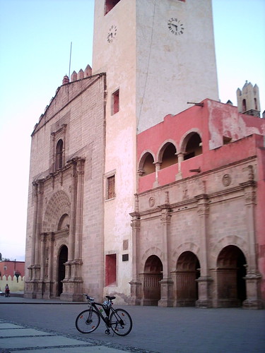
Actopan (Hidalgo), 06.11.05
Map Navigation: This dynamic Trackmap shows the GPS track (red line) of the cycling tour. Wheel up and wheel down to zoom in or zoom out. Click on any point in the map to center it on that point. Or just drag the map with your mouse.
Photoset Show
GPS Track: GPX (MapSource, et al.) or KMZ (Google Earth)
GPS Cycling Data: Distance: 111.6 Km, Ascent: 445 m, Time: 4:15 Hr, Avg. Speed: 26.2 Km/hr, Max. Speed: 60.1 Km/hr.
Travel Report:
I made this ride cycling along the paid highway to Pachuca, capital of the northern state of Hidalgo. After arriving to Pachuca I took the western deviation to Actopan. Although the road conditions along the sideway of the highway to Pachuca had been in general acceptable, after Pachuca and in Actopan direction the road becomes worst, with a lot of holes on the pavement. This is particularly critic as one nears Actopan.
Along the route impressive vistas could be appreciated. For example, the view of the train in Tecamac, or the hills near the San Pedro summit, or the small lakes lost in the middle of that desert. A vivid image I do remember is the mountains view at the Arenal, called Los Frailes. Pure desert and wind, but miraculously, beautiful diminutive flowers also :-)
Once I arrived at Actopan, I headed towards it center, where the beautiful Augustine convent of San Nicolas de Tolentino is located. An impressive stone cross stands before the entrance of the convent. And when the convent lights went on, a magnificent view of the entrance corridor along its interior park could be appreciated. You can have a look at the photos in the following photoset.
Thank you for reading. Till the next journey.

