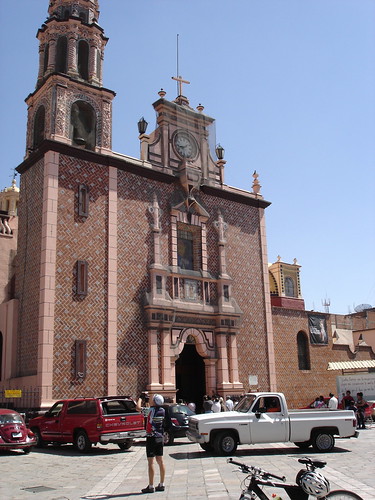
Texmelucan (Puebla), 19.02.06
GPS Track Video

Photoset Map
Photoset Show
GPS Track: GPX (MapSource, et al.) or KMZ (Google Earth)
GPS Cycling Data:


Distance: 150 Km, Ascent: 1990 m, Time: 7:23 hr, Avg Speed: 20.6 Km/hr, Max Speed: 70.1 Km/hr


Distance: 150 Km, Ascent: 1990 m, Time: 7:23 hr, Avg Speed: 20.6 Km/hr, Max Speed: 70.1 Km/hr
Travel Report:
This ride started and finished in the sub-urban train eastern terminus of La Paz, being made with the company of a fellow cyclist. The route used was the paid highway to Puebla, up to Texmelucan, both ways: cycling to Texmelucan (alt: 2250) and cycling back to Mexico City (2250 m). This route involved a double ascension to the Llano Grande summit (alt: 3220 m).
As this was a routine riding, mainly intended for training, there are no much things that could be related. At our arrival to Texmelucan, we headed to its market in order to have a delicious meal. We took some pictures of its beautiful cathedral and its stunning interior.
We cycled our way back to Mexico City, arriving at La Paz terminus with no problems at all.
Thank you for reading. Till the next journey.

No comments:
Post a Comment