Xihuingo Archaeological Site + Tepeapulco (Hidalgo), 23.04.06
GPS Track Video
Photoset Map
Photoset Show
GPS Track: GPX (MapSource, et al.) or KMZ (Google Earth)


Distance: 190 Km, Ascent: 833 m, Time: 7:13 hr, Avg Speed: 26.3 Km/hr, Max Speed: 63 Km/hr
This ride started early, as I was going to ride with a friend: Luis :-) We started the ride at 06:30, from the beautiful Independence Angel, in Reforma, in the heart of the city. The target or destination of the ride was the Archaeological Site of Xihuingo, in the northern state of Hidalgo, with a visit to its nearby town of Tepeapulco. The return leg of the trip was made also cycling. Hence the distance recorded by the GPS: 190 Km.
The route to Xihuingo in its first half resembles the route to the Pyramids in Teotihuacán, as the route is the same. So we took North Insurgentes in order to arrive to the paid highway to Tulancingo (Hidalgo) and Huauchinango (Puebla). As usual, this toll collect station did not allow us to cross it, so we had to make the usual turn around the station in order to continue along the highway :-(
The route is mainly plain up to Teotihuacán, as we had to ascend only 50 m to arrive at the Teotihuacan deviation. In fact, the whole route was relatively plain (compared with ridings to Puebla or Toluca, for example), as the maximum height was only 2550 m, only 300 m above Mexico City level :-)
But it was fun anyway, as we were riding across terra incognita, i.e. regions that we had not cycled before. I cycled seldom to this northern regions, and the constant I see is that the human and geographic mosaics are quite different here from the rest of the country surrounding Mexico City.
I have the feeling that in the northern regions of Hidalgo and Mexico State, there are less concentration of people, and the terrain looks to me a little more desolated, like in a desert :-( I mean, having cycled in to the south, east and west of Mexico City, when I ride to the north, I always got the feeling that I am in an alien country. Plain terrain, few water, almost no rivers or lakes, chilly wind, merciless sun, i.e. a desert's weather. Plus I seldom see the multiplicity of towns and cities one gets accustomed to see in other parts of the country. I could guess that this demographics is a direct result of the lack of water and desert-like weather conditions. But that was just my two cents. Anyway, I like all my country like it is :-)
After Teotihuacan stands the deviation to Otumba, to the east. So we took it and arrived to this pintoresque town. After Otumba we continued our way to Sahagun City. This part of the ride, between Otumba and Sahagun was the leg of the journey that astonished me more, as those are extended regions of plain terrain with no rivers or lakes in sight. The vegetation of those lands is low and primary comprised of bushes. And as I have stated before, no towns between both cities. Just the plain desert terrain ...
Once we arrived at Sahagun, the panorama changed, as this city is an industrial one, and has almost merged with the next town: Tepeapulco. We passed along Sahagun without entering in this city, as we have no time for that. In fact, when we arrived at Tepeapulco, we also passed along this town, in order to arrive early at the archaeological site of Xihuingo.
Xihuingo is reached by a road that exits from Tepeapulco. There is a small traffic signal announcing the dirt road to the archaeological site, but as this label is really small, we somehow missed it, so we were cycling past the entrance when we stopped to ask for the correct road to a local. Once we were told that we had missed the entrance, we remade back our steps a couple of kilometers, and finally found the track.
The track to arrive at the pyramids of Xihuingo is a dirt one, i.e. one that has no asphalt, only stones and dirt :-( Anyway, we continued along the road and finally arrived at where we supposed that the site should be present. To our dismay we had arrived early, in fact: too early ... since the care-keepers of the site were not even present ! So we were lost for some minutes, looking for the pyramids, and not founding them !
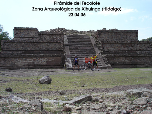
It sounds surreal how we could miss some big pyramids in the middle of that hill, but it was true. We looked for some minutes around the neighbouring, and finally Luis found the pyramid ! It happened to be that the pyramid was not so big in size, and that also the terrain was enigmatic, as there were several small hills (cerros), each one of them occulting a portion of landscape. That was how we could miss the Xihuingo pyramids for some minutes !
Xihuingo houses an impressive and beautiful pyramid: the Owl Pyramid (owing its name to an owl statue that was recovered from the front of the building).This pyramid shows clear teotihuacan influences in its construction. It even still shows on one of its sides the original red-colored stucco, which once adorned the whole building ! I think that the best way to describe this marvelous pyramid is having a look at it, via the photographs. The guardians of the site later told us that under the surrounding hills may be more pyramids, which are currently still un-earthed.
Once we finished studying the pyramid, we were encouraged by the guards to have a look at the front Squirrel Hill, where there are a lot of petroglyphs. We started the climbing to the summit of that hill, and on our way we were astonished by the multiplicity and variety of the existing petroglyphs. I am not sure about its meaning, but they certainly looked pretty interesting to me :-). Again, I invite you to see them in the photoset.
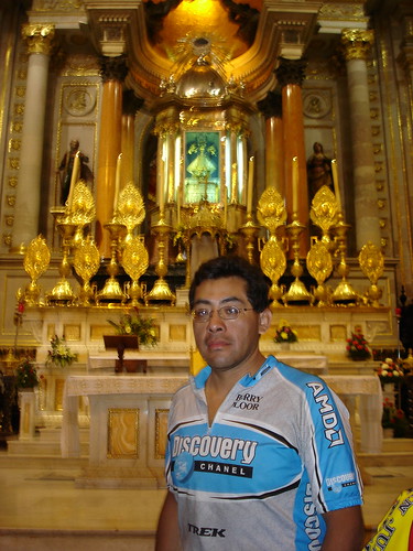
After we had reached the top of that petroglyphs hill, we descended it and told farewell to the site. We cycled back to Tepeapulco, where we went to its main plaza, and eat in its market. After the meal, we went to the ancient Franciscan Convent and enjoyed a cultural trip to a museum that is housed in that convent. In this museum, strips of the Sahagun informers codex (Florentino Codex) are exhibited, along with a lot of stone carved statuettes, pottery and ceramics, all of them reflecting teotihuacan and nahuatl influences.
Once we had finished our visit to the museum in the convent of Tepeapulco, we started to cycle the 90 km long way back home. On our way back I could see the same desolate landscape, with the plus that there was less light, adding with it a sombre touch. On our pass by Teotihuacan we could take some pictures of those magnificent pyramids, along the highway. They looked superb at the distance. We finally managed to arrive at Mexico City with no complications at about 19:00.
Thank you for reading. Till the next journey.


