Mexico City - Cuernavaca (Morelos) - Mexico City, 21.01.07
Map Navigation: This dynamic Trackmap shows the GPS track (red line) and some geo-referenced photos (red dots) of the cycling tour. Wheel up and wheel down your mouse to zoom in or zoom out the map. Click on any point in the map to center it on that point. Or just drag the map with your mouse. To see the photos, hoover the mouse over the red dots. Click on the photo to go to the picture page.

GPS Track: GPX (MapSource, et al), or KMZ (Google Earth)
GPS Cycling Data:


Distance: 147 Km. Ascent: 2360 m. Time: 6:37 hr, Average Speed: 22.1 Km/hr, Energy expended: 29.3 MJ, Cycling Power: 308 W, Specific Power: 4.1 W/Kg.
Travel Report:
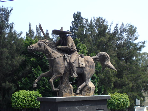
This ride started a little bit late (at about 11:00). Unfortunately, I couldn't take my digital camera with me this time, so I was unable to record some photographs of this tour. This was in part due to the nature of the ride, intended as a training ride, and not considered as a touristic one, owed to the fact that this route was not new to me (having done this route a number of times before). And taking photographs only of the Zapata (in the entrance of Cuernavaca) starts to appear a litte boring :-)
There was no traffic in the first leg of our journey. The route taken was the free highway to Cuernavaca. At 13:30 I reached the town of Tres Marías, and after that, it was all descent to Cuernavaca, arriving there half hour later. After resting another half hour there, I started the ascent to Tres Marías, arriving at this point at 16:15. After refuelling there my isotonic drink, I continued the remaining ascent to La Cima. After this point, the road is only descent to Mexico City, albeit a little bit dangerous for the high speeds attainable on the turns of this free highway. At the entrance of the city (full of traffic, by the way), I missed somehow the turn to take Tlalpan, so I had to make a big turn to Insurgentes and Periferico :-(
Thank you for reading. Till the next journey.

No comments:
Post a Comment