February 26, 2007

Tepoztlan Archaeological Site (Morelos), 25.02.07


Map Navigation: This dynamic Trackmap shows the GPS track (red line) and some geo-referenced photos (red dots) of the cycling tour. Wheel up and wheel down your mouse to zoom in or zoom out the map. Click on any point in the map to center it on that point. Or just drag the map with your mouse. To see the photos, hoover the mouse over the red dots. Click on the photo to go to the picture page.


Photoset Map

Photoset Show

GPS Track: GPX (MapSource, et al), or KMZ (Google Earth)

GPS Cycling Data:


Distance: 170 Km. Climb: 2615 m. Time: 7:15 hr, Average Speed: 23.45 Km/hr, Energy expended: 31.38 MJ, Cycling Power: 300 W

Travel Report:

Starting at 09:20, this ride was a long one. Certainly starting at a late hour, I decided not to stop before reaching Tepoztlán (the destination). So, I took Tlalpan and later the free highway to Cuernavaca. On Tres Marías I changed paths and took the paid highway to Cuernavaca. After La Pera curve there is the deviation to Tepoztlán (where I arrived at 12:12).

I headed immediately to the Archaeological Site, a hill known as the Tepozteco Hill. Rode the bike up to where it was possible (where the stone stairs start) and left the bike in the last food shop (delicious fruits and juices), where I could leave (attended) the bike. I started the ascent to the Tepozteco Hill, 400 m over the Tepoztlán valley, finishing it in 30 min. After taking some shots of this small archaeological site (and having a look at the incredible vista of the valley from the Tepozteco Hill), the descent was carried up (caveat: the track to the hill, the archaeological site of the Tepozteco Hill, and the whole town of Tepoztlán are packed with tourists !)

I went to the center of the town, and enter at Our's Lady Mary Convent of Tepoztlán (official name), to pay it a rewarding visit. This Convent is really impressive for its just restaurated frescos and arches. There is also a beautiful archaeological museum in its interior.

It was now time to get back to Mexico City. At 15:40 I started the ascent from the center of the town. Unfortunately I took the wrong way and was descending again to Cuernavaca ! After a kilometer or so, I turned back to Tepoztlán and was now in the right direction at the gas station at 16:20. At 16:57 I finished that infamous ascent to the paid highway to Mexico. I reached Tres Marías at 18:36, no without some minor physical nuisances as I was now mildly de-hydrated :-( Under the cover of the night I reached La Cima summit and started the descent to Mexico City (800 m below). I arrived safe at Tlalpan and took it to get back home at 21:00 :-)

Photos ? In the links above. Thank you for reading.

February 19, 2007

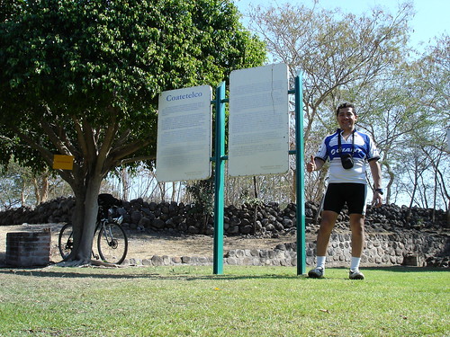
Coatetelco Archaeological Site (Morelos). February 18th, 2007


Map Navigation: This dynamic Trackmap shows the GPS track (red line) and some geo-referenced photos (red dots) of the cycling tour. Wheel up and wheel down your mouse to zoom in or zoom out the map. Click on any point in the map to center it on that point. Or just drag the map with your mouse. To see the photos, hoover the mouse over the red dots. Click on the photo to go to the picture page.


Photoset Map

Photoset Show

GPS Track: GPX (MapSource, et al), or KMZ (Google Earth)

GPS Cycling Data:


Distance: 160 Km. Climb: 1816 m. Time: 6:28 hr, Average Speed: 24.74 Km/hr, Energy expended: 28.2 MJ, Cycling Power: 302 W

Travel Report:

This ride started early, before 09:00 ! Took the free highway to Cuernavaca, and after crossing it I headed to Alpuyeca, where I could see a Chinelos (carnival) dancing. Headed towards Miacatlán, where two beautiful lakes could be admired (El Rodeo and Coatetelco). Once in town, I proceed to visit the archaeological site and Museum in Coatetelco. The return was for a different route, this one shorter to Alpuyeca. From here I ran the last ascent from the tour, heading again to Cuernavaca (this time uphills).

Thank you for reading. Till the next travel.

February 12, 2007

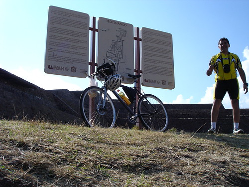
Teotenango Archaeological Site (Mexico). February 11th, 2007


Map Navigation: This dynamic Trackmap shows the GPS track (red line) and some geo-referenced photos (red dots) of the cycling tour. Wheel up and wheel down your mouse to zoom in or zoom out the map. Click on any point in the map to center it on that point. Or just drag the map with your mouse. To see the photos, hoover the mouse over the red dots. Click on the photo to go to the picture page.


Photoset Map

Photoset Show

GPS Track: GPX (MapSource, et al), or KMZ (Google Earth)

GPS Cycling Data:


Distance: 165 Km. Climb: 2350 m. Time: 7:01 hr, Average Speed: 23.4 Km/hr, Energy expended: 33.36 MJ, Cycling Power: 329 W

Travel Report:

This ride started at the relatively early hour of 07:00, but, as I was starting to climb Constituyentes in order to have access to the free highway to Toluca, I broke my chain, because one of its links opened itself, so I had to start looking for a bike repair shop at that early hour :-( Fortunately, I discovered a repair shop (in front of Parque Mexico) at about 2 km of the place where I broke my chain, so I could have repaired it. The tricky part was walking all that way with my carbon fiber SPD shoes ... :-(

After repairing my chain and proofing it (since the road was going to be pure ascent to the Tres Cruces summit, climbing: ca 1,000 m), at 09:50 I could restart the ride towards Toluca. Originally this ride was intended to visit the Archaeological Site of Huamango, but since I had already lost 3 hours, it was now impossible to arrive on time at Huamango, since it closes at 15:00. So I had to re-plan the ride, and after arriving at Toluca, I had to make up my mind. To where from here ?

I asked a police officer in the street about archaeological sites nearby Toluca. He offered me 2 options: Teotenango and Calixtlahuaca, but he recommend me Teotenango for its historical riches and museum. OK, so I decided to ride to Teotenango (Place of the divine wall). The road after Toluca is a little bumpy, since there are a lot of holes in the pavement, a world of difference with the streets of Toluca. Although the ride is mainly plain, I was starting to asking myself when I could arrive at Tenango del Valle, which is the name of the town that hosts the site. Somewhere in the middle of the road (later I knew this place name is Sta Maria Rayón) I found a big religious procession that was heading to visit the Guadalupe Basilica, in Tepeyac, Mexico City. This walking march would take them to this big religious sanctuary in three days ! And in the same town, I discovered an ancient dancing custom, where the kids of the travellers stayed at home, but dancing at the sound of indigenous musical instruments ! Wow, that was my pic of the day :-) It is very interesting knowing that even in presents days, five centuries later than the spanish conquest, there are still indigenous traditions, alive and kicking ! I hope I could find more of this really interesting and capturing traditions on my travels by Mexico :-)

After this dancing, I continued the ride and found along the road a fellow cyclist, with whom I could talk a little, since our destination was the same: Tenango del Valle, in fact, he guided me to the center of the town (he most ride back to his hometown: Toluca). I went to the market of Tenango, where I could eat some fruits (mainly citrics) in order to continue to the Pyramids.

The archaeological site is just a couple of minutes after the downtown. Once inside, I was recommended to visit the museum first, since it closed earlier than the rest of the site. So, I followed the guardian's suggestion and paid a due visit to the site's Museum. Inside the museum a myriad of sculptures and ceramics artifacts can been appreciated. There is even a room dedicated to the display of stone sculptures of nahua gods, really interesting. Its collection of pottery and ceramics is astounding. There are even paintings and some ancient musical instruments displayed. As a curiosity, in the museum are displayed some mammoth bones ... and tools for hunting and eating them, mmhh :-)

Once I had finished the visit to the museum, I started the climbing to the proper archaeological site. It is an almost a 100 m climb from the entrance, over a big-stone paved way, really tricky terrain to make a very steep ascent, if you mind. Some how I could finish it and at its end, the magnificent pyramids !

I took over my bike with me along platforms and pyramids, so I could access most of the site. This site is enormous ! And the weather could not be better, just sun and sun in sight, no hint of rain or stormy clouds :-) So I climbed to the plazas ... and discovered a lot of kids just plainly playing soccer on the plains of the site. I got the impression that people come to this site as a camping day (more that to study history), but well, this is _their_ place. I missed more signboards alongside the monuments, plazas and pyramids, telling the visitors the history and purpose of the buildings. Once I climbed to the top of one Pyramid, the vista was superb, as you can view all the surroundings in one clear shot. Along the stairs of one Pyramids, some reliefs can bee seen where the representation of an eclipse is depicted (represented by a sitting jaguar eating a flower or heart, in the year 2-rabbit).

After finishing this short visit to the Teotenango Pyramids, I went to the town of Tenago del Valle, where could know its Main Square, and its church, where I found the curious detail that the church had on its top our national flag, but with the national shield changed, from the eagle and serpent ... to an image of Christ ! My God, this is an illegal behaviour, but ... who is going to say a word about it (and mix up with the customs of a town) ? :-)

I had now to return as fast as possible to La Marquesa, since I had only a couple of hours with solar light. In my return to Mexico City, instead of returning via Toluca (which proved to be a big turn), I choosed to ride directly to La Marquesa. This road passes through Texcalyacac, and the deviation to Tianguistenco and Xalatlaco. After the last town of Texcalyacac, a 600 m climbing starts that will take us to La Marquesa, where I arrived at the late hour of 18:38. From here another ca. 200 m climbing remained in front of me before reaching again Tres Cruces, which I arrived at 18:54. Light was almost off now, so I had to descent almost 1000 m (elevation), again in darkness. As I have done this nocturnal descent a couple of time before, I lost no time and went for the last leg of my journey, reaching the end of this travel at 19:40 in Mexico City, again safe and sound :-)

Till the next ride, and thank you for reading :-)

February 05, 2007

Huamango Archaeological Site (Mexico). February 4th, 2007


Map Navigation: This dynamic Trackmap shows the GPS track (red line) and some geo-referenced photos (red dots) of the cycling tour. Wheel up and wheel down your mouse to zoom in or zoom out the map. Click on any point in the map to center it on that point. Or just drag the map with your mouse. To see the photos, hoover the mouse over the red dots. Click on the photo to go to the picture page.


Photoset Map

Photoset Show

GPS Track: GPX (MapSource, et al), or KMZ (Google Earth)

GPS Cycling Data:


Distance: 160 Km. Ascent: 1810 m. Time: 6:40 hr, Average Speed: 24 Km/hr, Energy expended: 30.92 MJ, Cycling Power: 322 W, Specific Power: 4.27 W/Kg

Travel Report:

This ride started two hours earlier than last week, but (as I will explain later), it was not sufficient :-(. At 10:00 I started the ride to the archaeological site at Huamango, in the north of the neighbouring state of Mexico. I took Alvaro Obregon in order to reach Constituyentes, so I could take the free highway to Toluca, first leg of my journey. I started this climbing from an elevation of 2250 m all the way up to the summit at Tres Cruces, at an elevation of ca. 3200 m, 25 km later (4 % grade). After Tres Cruces comes an interesting descent all the way down to Lerma (alt: 2600 m, 15 km later). I continued the route to Toluca (state capital), arriving at this city at km 60.

In the monument to the god Tolo, on the Tollocan Boulevard, I took the deviation to Atlacomulco. This highway is a paid one, but there were no problems at all when crossing the toll stations. Once on this highway, I entered the Ixtlahuaca region, the name meaning: "in the plains", arriving at the city of Ixtlahuaca at km 96. Here is a gas station where you can refill the isotonic drink. Ahead on the road I could know the famous Hacienda Pastejé. After passing the second toll station, I arrived at Atlacomulco at km 125.

The following leg of my journey awaited in front of me, with an ascent of 200 m in 5 km (4 %). Although this ascent was not so demanding, being performed at km 130, it started to hurt the legs. After those climbings, Acambay was already in sight :-), arriving at this picturesque town at km 147, and with an elevation of 2550 m.

But, and as I have started to recognize as a proven custom, the archaeological site of Huamango is located uphill the nearest town, so I still needed to climb another 350 m in only 5 km (7 % grade), but all this at km 150 on my route. Additionally, the weather had changed extremely rapid, and now on the top of the mountain that lied ahead was already an enormous gray cloud that threatened to evolve into rain. I weighted my chances, but I hadn't rode so far to this point only to be taken back in the last 5 km for a rain warning. It would take a lot more than that ! So, I continued my ride to the mountain.

The problem (and the biggest problem so far) was the extreme cruel wind on the ascent, and worst of all, the wind came from the right, threatening to take me to the left side of the lane, meaning to the area where the 18 wheelers and cars were bypassing me. I felt horror just thinking in the case where the wind could blow me to the left side of the lane and a big truck were passing by at the very same moment. But I had to arrive at the archaeological site. The wind blowed and blowed really strong, but somehow I could manage to maintain control on the handlebars of my bike (coupled with my own weight, 75 kg, which also could have played a role in my equilibrium).

When I arrived at Dongú (middle point in the ascent to Huamango), the wind started to blow with less force, so I could continue my climbing without such macabre thankings. Later, at 2700 m elevation, I arrived at the landmark signaling the _start_ of the proper road to the archaeological site. This road is another cruel ascent of 200 m in only 2 km (10 %). The pavement of this road is even featured with anti-skid markers, in order to avoid automobile accidents ! After climbing this road, making "S"s, I finally arrived at the archaeological site entrance, at 2900 m.

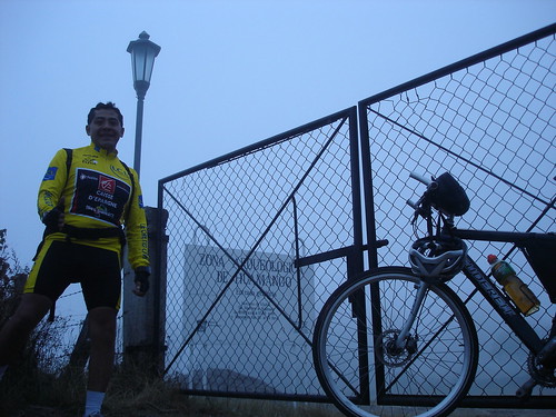
But, and as in the Greek tragedies, the site had already closed ! It even closes Sundays at the really early hour of 15:00 ! Additionally, there was an extreme freezing cold (although i carry a termometer-sensored watch, I forgot to take a thermal reading) and a eally dense fog, which rendered optical vision useless after 10 m. What a pity ! And the web page of the INAH (national administration of historical sites) stated that the site closed at 18:00 ! But anyway, what more could I do ? I checked if the site's door was locked ... effectively it was, and with a big lock ! So I could not do anything more than took a few shots, and undertook the return to Acambay. On the top of that hill the cold and moisture were so extreme that I got my crank locked with the chain ! I was only so lucky dicovering that I got the crank locked for the ice in the chain (and was unable to change plates) _before_ I started the descent :-)

At the landmark I took the last photo of the site, wondering if this last shot couldn't cost me my descent to Acambay (350 m), again, under the cover of the night. Certainly, it did. I had to manage my descent partly in darkness, arriving to the safety of Acambay without solar light. I must thank the car drivers that drove after me in that nocturnal descent, for having behaved extremely courteous, by driving behind me at my speed and with their intermittent lights on :-) Thank you guys !

Once in Acambay, and after having checked the time for the last bus to Mexico City, I decided to pay a very short visit to the Main Square of this town, visiting its Cathedral and Elementary School, both located face to face (?), a little bit like the Atlacomulco downtown, where the Municipal Palace stands between the Cathedral and the School. Interesting urban arrangements :-)

I returned to the bus station in Acambay (it is an euphemism, since a real station is non-existent, as passengers have to wait on the highway), where I could take the last bus to Mexico City (en route from Queretaro), which arrived at 19:30 (cost: 85 pesos), arriving at our destination 2:15 hrs later.

But: between Huamango and me, we still have unfinished business ... so I plan to remake this route next week, with the additional detail of departing my house at 06:00 next Sunday. I think it is the only way to assure an entrance to the archaeological site. The problem is: how could I wake up next Sunday at 4:00 (when I usually go to bed at that hour on Saturdays) ? That is the big question :-)

Till the next travel ! And thank you for reading :-)