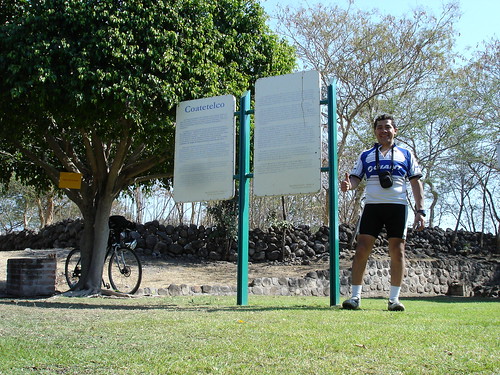
Coatetelco Archaeological Site (Morelos). February 18th, 2007
Map Navigation: This dynamic Trackmap shows the GPS track (red line) and some geo-referenced photos (red dots) of the cycling tour. Wheel up and wheel down your mouse to zoom in or zoom out the map. Click on any point in the map to center it on that point. Or just drag the map with your mouse. To see the photos, hoover the mouse over the red dots. Click on the photo to go to the picture page.

Photoset Map
Photoset Show
GPS Track: GPX (MapSource, et al), or KMZ (Google Earth)

Photoset Map
Photoset Show
GPS Track: GPX (MapSource, et al), or KMZ (Google Earth)
GPS Cycling Data:


Distance: 160 Km. Climb: 1816 m. Time: 6:28 hr, Average Speed: 24.74 Km/hr, Energy expended: 28.2 MJ, Cycling Power: 302 W


Distance: 160 Km. Climb: 1816 m. Time: 6:28 hr, Average Speed: 24.74 Km/hr, Energy expended: 28.2 MJ, Cycling Power: 302 W
Travel Report:
This ride started early, before 09:00 ! Took the free highway to Cuernavaca, and after crossing it I headed to Alpuyeca, where I could see a Chinelos (carnival) dancing. Headed towards Miacatlán, where two beautiful lakes could be admired (El Rodeo and Coatetelco). Once in town, I proceed to visit the archaeological site and Museum in Coatetelco. The return was for a different route, this one shorter to Alpuyeca. From here I ran the last ascent from the tour, heading again to Cuernavaca (this time uphills).
Thank you for reading. Till the next travel.

No comments:
Post a Comment