June 27, 2007

Tula Archaeological Site (Hidalgo), 24.06.07

Map Navigation: This dynamic Trackmap shows the GPS track (red line) and some geo-referenced photos (red dots) of the cycling tour. Wheel up and wheel down your mouse to zoom in or zoom out the map. Click on any point in the map to center it on that point. Or just drag the map with your mouse. To see the photos, hoover the mouse over the red dots. Click on the photo to go to the picture page.


Photoset Map

Photoset Show

GPS Track: KMZ (Google Earth), or GPX (MapSource, et al).

GPS Cycling Data:


Distance: 193 Km, Total Ascent: 1100 m, Cycling Time: 8:02 hr, Avg. Speed: 24 Km/hr, Max Speed: 57.1 Km/hr, Energy Expended: 36 MJ, Cycling Power: 311 W.

Travel Report:

Owed to the fact that on the previous day I had to attend a late-night compromise, this ride started at the insane late hour of 12:00 !

I had decided for this ride to the
Tula Archaeological Site, not to take the paid highway to Querétaro (as I had taken a lot of times this highway), riding instead by the old (and free) highway. Starting from Mexico City center, I rode towards Tlalnepantla, Cuautitlán, Teoloyucan, Huehuetoca, and Jorobas.

From Jorobas, I had to take a choice between 2 different paths: the paid highway (that I had used a lot of times), or the free road passing by the Tula Refinery. I choosed the last one, always wanting to know something new. But the road conditions were less than ideal. The asphalt carpet is eroded and full of holes, caused by the big trucks that roam freely on this highway.

The landscapes along the Refinery road are speechless ! Full desert ! I seldom ride on the northern side of Mexico City, but each time I do it, I always feel struck by the incredible vistas along the desert ! Accustomed as I am to the humid landscapes of the south and east part of my country, being in in the northern deserts resembles me like travelling in an entire different planet !

Unfortunately, my camera stopped working in Huehuetoca, since I was carrying it in the handlebar bag (lots of vibration), so I am not able to offer you a glimpse of those beautiful desert vistas.

Following the road ahead, after good 100 km, I could finally arrive at the Tula Archaeological Site, just 15 minutes later than last allowed entrance time (17:00). So, after crossing some words with the guard, I cycled my way back to Mexico City, arriving past 22:00 hr, under full night cover.

I hope to remake this travel next week, but departing now at 07:00, so I could finally enter at the beautiful Tula archaeological site. And now, with a working photo camera !

Thank you for reading. Till the next travel.

June 18, 2007

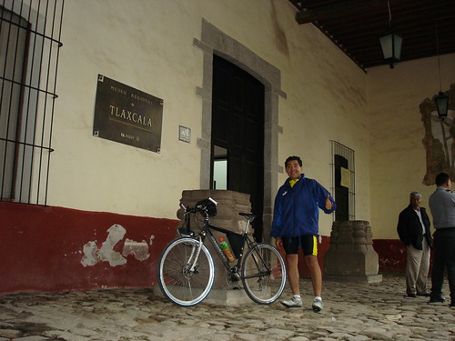
Tlaxcala Regional Museum (Tlaxcala), 17.06.07


Map Navigation: This dynamic Trackmap shows the GPS track (red line) and some geo-referenced photos (red dots) of the cycling tour. Wheel up and wheel down your mouse to zoom in or zoom out the map. Click on any point in the map to center it on that point. Or just drag the map with your mouse. To see the photos, hoover the mouse over the red dots. Click on the photo to go to the picture page.


Photoset Map

Photoset Show

GPS Track: KMZ (Google Earth), or GPX (MapSource, et al).

GPS Cycling Data:


Distance: 143 Km, Total Ascent: 1200 m, Cycling Time: 6:18 hr, Avg. Speed: 22.6 Km/hr, Max Speed: 70.7 Km/hr, Energy Expended: 27 MJ, Cycling Power: 300 W.

Travel Report:

Owed to the fact that on the previous day I had to attend a late-night compromise, this ride started at the late hour of 10:00, sadly.

I took the usual way of Zaragoza Av to the usual gigantic traffic jam that already was in its position, at the junction between the free and paid Puebla highways. I cycled all the way up (by the free highway), passing the town of Avila Camacho, to the Llano Grande summit (1000 m ascent), and later, descending all the way down to Sn Martin Texmelucan (Puebla).

From Texmelucan I took the free highway to Tlaxcala, an easy plain 25 km long ride, that gently took me to the heart of that beautiful city. Once there I headed directly to the Sn Francisco Ex-Convent, site of the Tlaxcala Regional Museum, located in the top of a hill, near the center of Tlaxcala.

The museum has several exhibition rooms. The first of them houses several pre-hispanic archaeological findings, unearthed from all the state of Tlaxcala. From this exhibition are worth mentioning the sculptures of Camaxtli and Teocipactli, Tlaxcallan indigenous gods, that were worshipped only there (and not by the rest of the nahua cultures). Several poly-chromated ceramics are also shown, which were used in religious rituals. I could even see a couple of Olmec artifacts ! These Gulf Culture ritual axes were found in Huamantla, and are thought to have been made in Veracruz. The rest of the Museum is devoted to the exhibition of colonial and contemporary art works. You can have a glimpse of the items exhibited in the Museum in the above linked PhotoSet Show.

After finishing my visit to the Museum, I had to wait at the entrance of it, since the heavy rain that had started one hour ago had still not finished. Once the rain stopped, I could start the return leg of my journey, this time cycling back to Texmelucan.

Unfortunately, the road was still wet, so I had to accept the fact that I was going to arrive at Texmelucan made a soap. But heck, this was better than last ride full sun, from which I still carry the solar burns on my skin.

Arriving at Texmelucan at about 20:00, it was a no-brain choice taking the return bus to Mexico City, which for only 54 pesos took me and my bicycle back home :-)

Thank you for reading. Till the next travel.

June 04, 2007

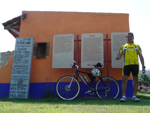
Tizatlan Archaeological Site (Tlaxcala), 03.06.07


Map Navigation
: This dynamic Trackmap shows the GPS track (red line) and some geo-referenced photos (red dots) of the cycling tour. Wheel up and wheel down your mouse to zoom in or zoom out the map. Click on any point in the map to center it on that point. Or just drag the map with your mouse. To see the photos, hoover the mouse over the red dots. Click on the photo to go to the picture page.


Photoset Map

Photoset Show

GPS Track: KMZ (Google Earth), or GPX (MapSource, et al).

GPS Cycling Data:


Distance: 160 Km, Total Ascent: 1400 m, Cycling Time: 7:28 hr, Avg. Speed: 21.4 Km/hr, Max Speed: 60.3 Km/hr, Energy Expended: 30 MJ, Cycling Power: 280 W.

Travel Report:

This ride started at about 08:00 (or 3 hours later than self-proposed). From the center of the city I took the Zaragoza Av. all the way to the eastern terminus of the city, but just arriving to the bifurcation between the free and paid highways to Puebla, the whole road was being blocked by the police, as reparation to the road were being made. Fortunately, as I was taking a picture of the gigantic traffic mess, the police opened the road, so I could say that I was the first one to take the free highway, at least that day. Why ? Because I, as soon as I heard the police order to continue, I was able to position myself in front of all the traffic that was just beginning to advance to the free highway :-) Life is made of simple things, isn't it ?

I continued inside of Ixtapaluca, where I could see several cars and pickups with cyclists waiting. I guessed at that moment they were waiting for more cyclists. And in fact, I was able to see them later on the highway, as they were part of a cycling race, which departed from Ixtapaluca and ended in the Llano Grande summit. At the end of the urban Ixtapaluca I could see more cyclists waiting.

Nonetheless, I started the ascent, passing firstly the town of Zoquiapan. On my way to the Llano Grande summit, I was reached by the cycling race that was taking part. Remembering my last week broken chain I reminded myself about the importance of a good cadence in cycling, so this time I was not able to match this cycling race. I had to accept the fact that those cyclists were better cyclists than me :-)

At my arrival to Avila Camacho, I was so hungry that I stopped for some bananas and apples. After that short gastronomical stop, I continued the ascent. Almost reaching the summit, I could enjoy the breath-taking panoramic views that the volcanoes that surround the Mexico City Valley offered to my eyes. In the crystalline air of the morning, and having shorted the distance to the volcano. it offered and impressive vista, with its top covered in snow.

At my arrival at the Llano Grande summit, I could have a glimpse of what a strong cycling group looked like :-) There were more than 50 racers that were celebrating their winning ceremony. I crossed some words with one of the racers, and after that, I continued my journey to the other side of the mountain, towards Texmelucan.

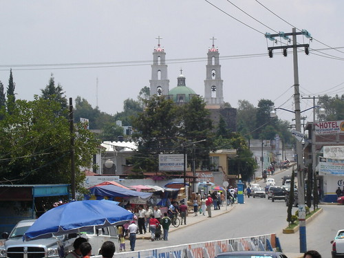
Arriving at Texmelucan, I took the 25 km long, plain road that would take me to Tlaxcala, the state capital of the Tlaxcala state. At my arrival at Tlaxcala, I took the deviation to Tizatlán, about 5 km north-east of Tlaxcala City. In Tizatlán I had to climb the steep hill where the town's church is located to finally arrive at the Tizatlán Archaeological Site. Tizatlán was the head of government of one of the four city-states that formed the Tlaxcalan Republic, etern enemy of the Nahua Empire. Xicotencatl was its ruler, and old and wise king, whose son, Xicotencatl Axayacatzin (the younger) fought bravely the spanish conquerors, until its execution by Cortes.

The point of this archaeological site is that it houses an interesting collection of pre-hispanic frescoes painted on several basements, which are in fact poly-chromated altars. You can have a look at these stunning paintings in the above linked photoset show. It is really interesting seeing how, in spite of having being painted more than seven centuries, the frescoes are still trying to tell us, its spectators, a story that still wants to be told.

Once finishing my visit to the impressive frescoes, I paid a short visit to the site museum, which houses several descriptions of the history and richness of the site.

In the same site, there is a beautiful open chapel, which also happens to have a lot of beautifully painted frescoes housed in its interior. The open chapels, which covered only the altar, and used no roof for the rest of the Cathedral, were erected in the first years of the colonization, with the purpose of being more attractive to the numerous indigenous population, still to be converted to the cristianism.

After taking some pictures of a monument erected to Xicohtencatl Axayacatzin, with the impressively beautiful La Malintzin volcano in the background, I started the returning leg of my journey, cycling firstly back towards Tlaxcala, by the paid highway to Tlaxcala. After that, I took the free highway to Texmelucan.

It was 18:30 when I arrived back at Texmelucan. Realizing that a cycling return to Mexico City would paramount to suicide (I don't want more nocturnal descents from Llano Grande), I took the wise (as in: coward) decision to abort the cycling return to Mexico and instead, I took the AU bus, which for 54 pesos took me safely back home :-)

Thank you for reading. Till the next travel.