Xochitecatl Archaeological Site (Tlaxcala), 26.03.06
Map Navigation: This dynamic Trackmap shows the GPS track (red line) of the cycling tour. Click on any point in the map to center it on that point. Wheel up and wheel down to zoom in or zoom out. Or just drag the map with your mouse.
Photoset Map
Photoset Show
GPS Track: GPX (MapSource, et al.) or KMZ (Google Earth)
GPS Cycling Data:


Distance: 102 Km, Ascent: 1174 m, Time: 4:29 hr, Avg Speed: 23.1 Km/hr, Max Speed: 61.6 Km/hr


Distance: 102 Km, Ascent: 1174 m, Time: 4:29 hr, Avg Speed: 23.1 Km/hr, Max Speed: 61.6 Km/hr
Travel Report:
I do not remember exactly at what time did I start this particular ride, but I do remember it was very late, about 10:30 maybe ? This ride is of the time of my beginnings as a humble cyclist, so sometimes I used to start the cycling ride not in my house, but instead in the eastern terminus of the suburban train. That saved me of cycling about 20 Km ! Cheating, eh ? But please don't forget that everyone of us has been once a beginner :-)
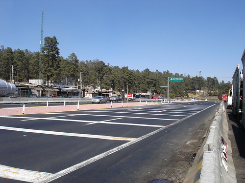
I don't have the exact hour I started that ride in the eastern terminus of the suburban train (named La Paz: the Peace), but it must have been about 12:00. In that time I used to start to ride a lot later, for reasons still unknown to me. I rode my way to the paid highway to Puebla (a deviation to the right before the entrance arc of Ixtapaluca). I merged with the paid highway at Km 21. From here I continued to the toll collect station at Km 35 (alt: 2250 m), where the ascent to the Llano Grande summit (alt: 3200 m) starts.
This paid highway is really a jewel to the cyclists. Although it is a paid one, and consequently cyclists have to ride on the sideway, the sideway of this highway is exceptionally flat, at least compared with other paid highways (i.e. to Cuernavaca and Toluca, for example). Another advantage is that there are several commercial stops along the highway, where you can buy water or food, if needed. Other paid highways (again, to Cuernavaca and Toluca) have seldom shops along the road.
So I made that 1000 m climbing to Llano Grande, and later, of course, its descent to Texmelucan (alt: 2250 m), reaching it at Km 75 of my route.
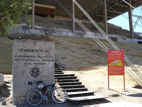
After Texmelucan (Puebla) I took the road to Villa Alta, which is the first town located in the state of Tlaxcala, being the frontier between both states in some point between Texmelucan and Villa Alta. In reality, the human and geographic mosaic changes very little :-) I rode later towards Tepetitla, and finally to Xochitecatitla, being this one the last town before arriving at my destination: the Archaeological Site of Xochitecatl. But before I could reach the site, I had to climb a really steep ascent of 100 m in less than 1 Km (a grade of 10 %). I finally could arrive at the archaeological site entrance at about 15:45. I left my bike at the entrance of the site as its entrance was not allowed, told me the site guards.
The first pyramid I visited was a circular one ! In fact, this is the first pyramid with circular basement and body I had ever seen. Another curiosity is that this pyramid features no stairs ! Its tiers are separated by more than 1 m, and in some cases, even 2 m. It is speculated that a ramp circled around this pyramid (in a spiral fashion) in order to allow for its climbing. Nowadays an artificial metal stair is allocated over the pyramid building to allow the access to its top. Another curiosity is that two trees are firmly rooted in this circular pyramid :-)
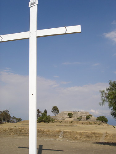
But another surprise wait for us at the top of the circular pyramid: a big white cross ! Over the top of an ancient nahua pyramid ! Well, this site is full of surprises. Still in our days, this very cross is the destination of numerous pilgrimages of the local people, for some reason I don't know :-( All I can extract is that this is a powerful sample of the religious syncretism that resulted from the fusion of two believing systems: the indigenous and the spanish. I think the best way you could grasp the contrast between both cultures is by having a lot at its pictures in the photoset.
Once I has finished my visit of this pyramid, I climbed my way down and directed myself to the next big pyramid: the Flower Pyramid. This one is even bigger than the previous Spiral Pyramid, and housed in its top some kind of temple. Currently, only some stones of that temple remain. Between both pyramids another buildings remain, and also, two very big pots, about 2 m in diameter ! I don't know its purpose, as they are only labeled as ceremonial pots.
Another building that is present in the site is what is termed the Volcanoes Platform. It is of low height and stands in the middle of the plaza, hence it is estimated it was the platform of a ceremonial center, that is currently destroyed.
Once I climbed my way up to the top of the Flower Pyramid, an impressive vista appeared before my eyes. The whole valley is appreciable from here. Really, the view is astounding. 360 degrees of clear vision from the top of the heights of the highest pyramid in the region ! The neighbouring archaeological site of Cacaxtla is even visible from this position. Also, on the top is present what remains of a temple built there, although currently only some vestiges remains.
Once I had enjoyed that incredible vista, I climbed down and went to the entrance for my bike, as the site was now closing. It was really a beautiful visit to an extraordinary archaeological site.
I cycle my way back to Texmelucan, passing again: Xochitecatitla, Tepetitla, Ayecac, and Villa Alta. In Texmelucan I took the bus back home, arriving at Mexico City without incidents.
Thank you for reading. Till the next journey.
