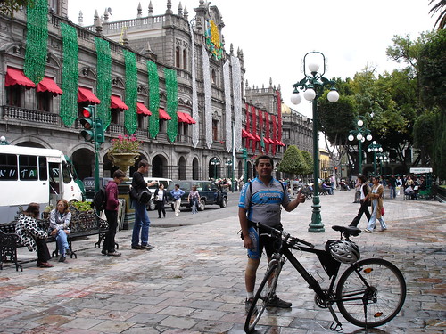
Puebla (Puebla), 25.09.05
Photoset Show
GPS Cycling Data: Distance: 111.7 Km, Ascent: 1329 m, Time: 6:06 hr, Avg. Speed: 18.3 Km/hr, Max. Speed: 63 Km/hr.
Travel Report:
This ride started in the eastern sub-urban train terminal La Paz. From there I took the paid highway to Puebla, passing on my way: Huixtoco toll collect station (elev: 2250 m), Llano Grande summit (3220 m), Texmelucan (2250 m), and from here, direct to the beautiful city of Puebla :-)
One little problem: as I had wrongly started to ride too late, in the last kilometers towards Puebla the night caught me, and worst of all: owed to the fact that the highway had been expanded to six lanes, the side lane where cyclists usually ride to arrive at Puebla was non-existant. In this fashion, without diurnal light, without side lane, and without cycling lamps, I was not able to cycle in the main (car) lane. On some parts I had to abandon the highway and cycle at the dirt side of the highway, but without sun or moon, this task probed to be a very difficult one. The good news was that it were only some segments that had not the side-lane. Once in the entrance of Puebla, I was again safe :-)
I took some photos of the road and also, from the city of Puebla. You can see them at the following photoset.
Thank you for reading. Till the next travel.


No comments:
Post a Comment